Lynx Software - Extensions for ESRI ArcGIS Desktop

Lynx Extensions for ESRI ArcGIS Desktop

Lynx provides a number of plug-in extensions for ESRI ArcGIS Desktop®.
ESRI is the market leader in GIS solutions, and its ArcGIS Desktop application suite is an essential tool for Explorationists.

Lynx has developed extensions which complement and extend the existing functionality in ArcMap:

Lynx currently supports ArcGIS Desktop versions 10.8 (including 10.8.1), 10.7, 10.6, 10.5, 10.4, 10.3, 10.2, 10.1 and 10.0.


Lynx Clickrelate

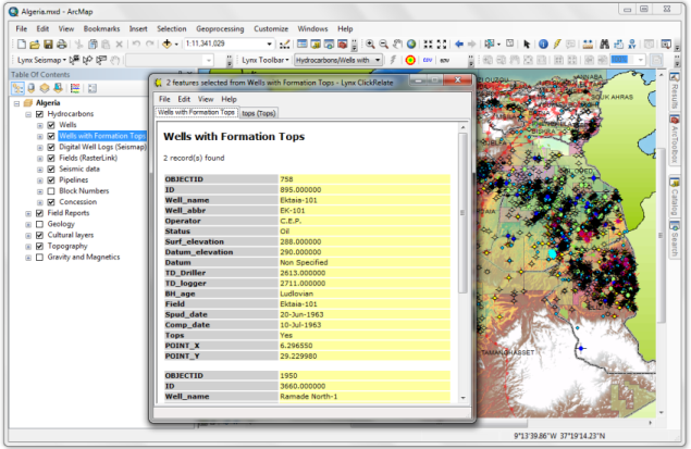
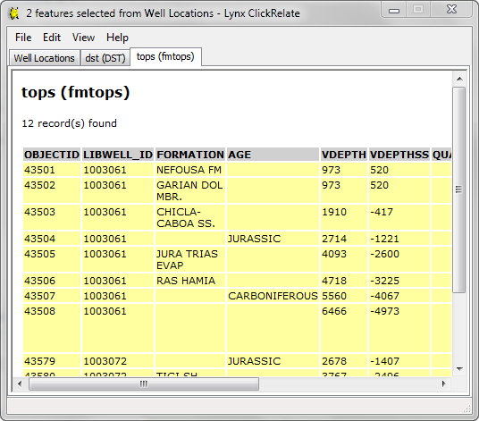
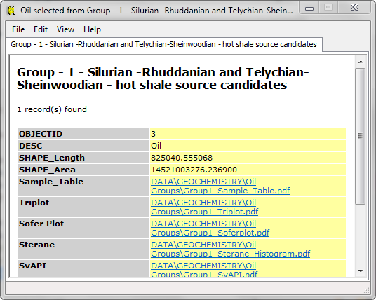
Clickrelate provides a method of viewing attributes for selected features in ArcMap, displaying the attribute field values for selected features and related table records in user-friendly browser windows. This is an alternative to using ArcMap's built-in 'Identify' window or navigating through the attribute table grid view

Clickrelate screenshot in ESRI ArcMap


The displayed results can be printed, copied to the clipboard for use in other applications, or saved as HTML. Matching records from related tables (one-to-one or one-to-many joins) can be viewed by clicking the tabs at the top of the browser window, providing easy and intuitive access to all the relationships defined for the feature layer. Additional documents can be accessed via hyperlinks - these are automatically displayed for internet URLs or valid file paths.

Clickrelate requires no additional configuration - it works with any feature layer and any table relationships defined either within the ArcMap map document (MXD) or as part of the underlying geodatabase.

The browser display provides both a list-based and a tabular view of selected records, and the display can be further customised if required by editing the supplied XSLT style sheets.

Clickrelate browser window showing related table


Clickrelate window showing hyperlinked attributes


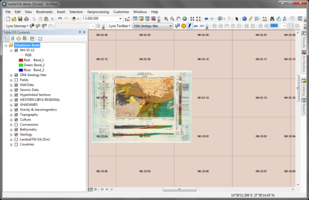
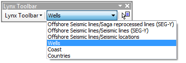
To activate Clickrelate, select your layer of interest from the drop-down list of layers in the Lynx Toolbar installed in ArcMap, then select features using the Clickrelate tool button:

Lynx toolbar in ESRI ArcMap

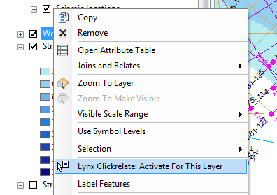
or you can activate Clickrelate from the layer's context menu in the table of contents:

Activate Clickrelate from the layer context menu


Download a trial version of Clickrelate here.

Back to top


Lynx Rasterlink

Rasterlink provides quick access to georectified images in a raster catalogue or hyperlinked feature layer. It enhances ArcMap's built-in support for georeferencing, handling all ESRI-supported formats, including MRSID, TIFF and ERDAS.

When an ArcMap project contains a large number of georectified images, it quickly becomes unwieldy and slow to respond to scrolling and panning. Rasterlink provides a hotlink tool which will add the georectified image for each selected feature to the current data frame, and display in place.

Tiled images accessed with Rasterlink in ESRI ArcMap


Using Rasterlink avoids the need to create map documents containing large numbers of georectified image layers in the table of contents, since images can be quickly accessed by clicking a polygon or centroid on the map. It provides 'point and click' access to raster images without having to drill down through complex data structures.

Download a trial version of Rasterlink here

Back to top


Lynx Seismap

Seismap is a powerful tool for viewing exploration data within ArcMap. It provides viewers for 2D and 3D seismic data, wireline curves and formation tops for wells, and cross-sections, all fully integrated into ArcMap. Seismap also incorporates import/export tools for common E&P data types.

Click here for a full specification of Lynx Seismap, or download a trial version of Seismap here.


Licensing of Lynx Extensions for ArcGIS

All Lynx software requires an activation licence after the expiry of the trial period. Licences can be bought from Lynx - see prices here.

To load the activation licence when you receive it by email, select the 'About Lynx Toolbar' option from the menu in the Lynx Toolbar in ArcMap, then click the 'Licence' tab in the About box displayed. Click the 'Load Licence' button and browse for your received licence file. You may require administrative privileges on your PC to install the licence file.


ArcMap® and ArcGIS® are registered trademarks of ESRI Inc.