
Kazakhstan - Lynx GIS Adviser
New in 2011
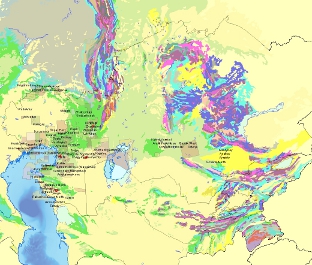
The Lynx Kazakhstan Adviser covers the whole of the country although it has a primary focus in the west, particularly around the northwest Caspian region. The GIS contains regional themes including:
- Surface Geology
- Tectonics
- Structural Framework
- Gravity (DMS2008)
- Magnetics (EMAG2)
- Elevation and Drainage (SRTM 90m)
- Landsat 14.25m
- Culture
- Pipelines
- Well Locations (over 15,000)
- Fields (300+)
- Licence Blocks and Concessions
- Seismic line locations (over 3,500 lines)
- Field Atlas
Lynx has reworked published field data (mostly from Russian) for approximately 200 Kazakhstan fields which include production and reservoir parameters, structure maps, cross-sections and well logs. Where possible field maps have been georectified and gridded and other data hyperlinked to the fields.
- Central Eurasian Atlas (YUGGEO)
Lynx has updated and extensively reworked Kazakhstan data from this atlas. A large ArcGIS geodatabase has been built including lithostratigraphic and sedimentological data for over 40 intervals from the Pre-Cambrian to Recent. Regional isopachs and structure maps have also been produced. Also included are over 600 key sections (outcrops, borehole and wells) which are hyperlinked to their locations.
- Lynx Digital Seismic and Well Data
Lynx can provide additional seismic and well data as an optional extra to customers with existing entitlement rights
Please contact us if you would like more information on the contents of the Kazakhstan GIS Adviser, or to arrange for a demo.